Access, circulation and external works
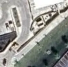
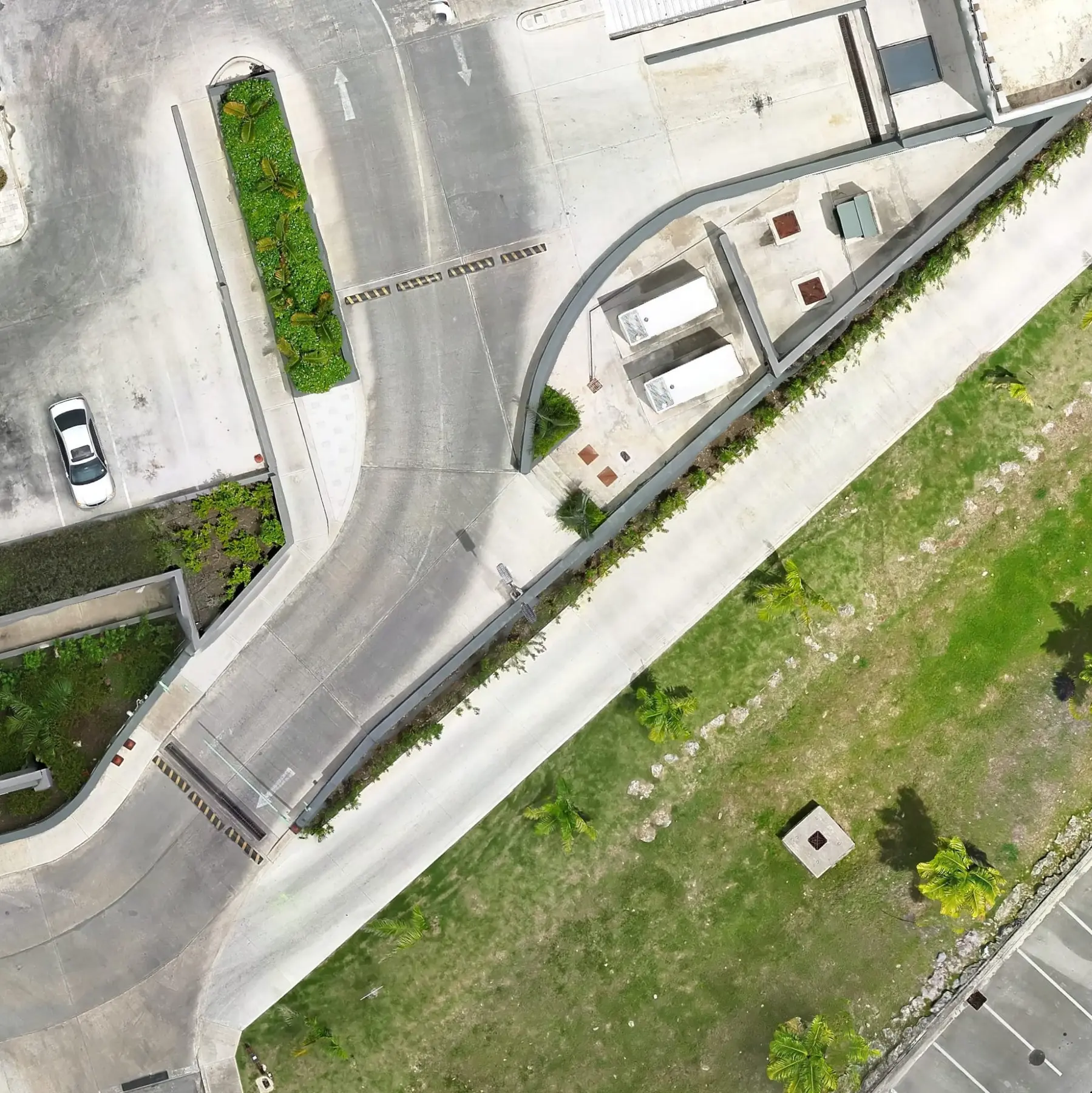
The dedicated orthomosaic resolves current access geometry, surface markings, landscaped areas, utilities and boundary relationships that are difficult to interpret in the lower-resolution satellite reference.
 Discuss a mapping project
KAJH Aerial · Orthomosaic mapping
Orthomosaic mapping
This is not simply a high-resolution aerial photograph. It is a processed spatial record of what was physically present across W Plaza Welches at the time of capture.
The orthomosaic supports dimensional measurement and site-scale assessment; review of building footprints, circulation, external works and visible site features; comparison with drawings, plans or previous captures; construction-process validation; change documentation; planning, coordination and remote site review. It provides practical site intelligence without being presented as a certified land survey or cadastral record.
Full-site record
Captured once. Referenced repeatedly.
A high-resolution orthomosaic consolidates the mapped site into one continuous current visual record. Instead of searching through hundreds of individual photographs, a building, entrance, roadway, parking area or site feature can be found by navigating directly to it.
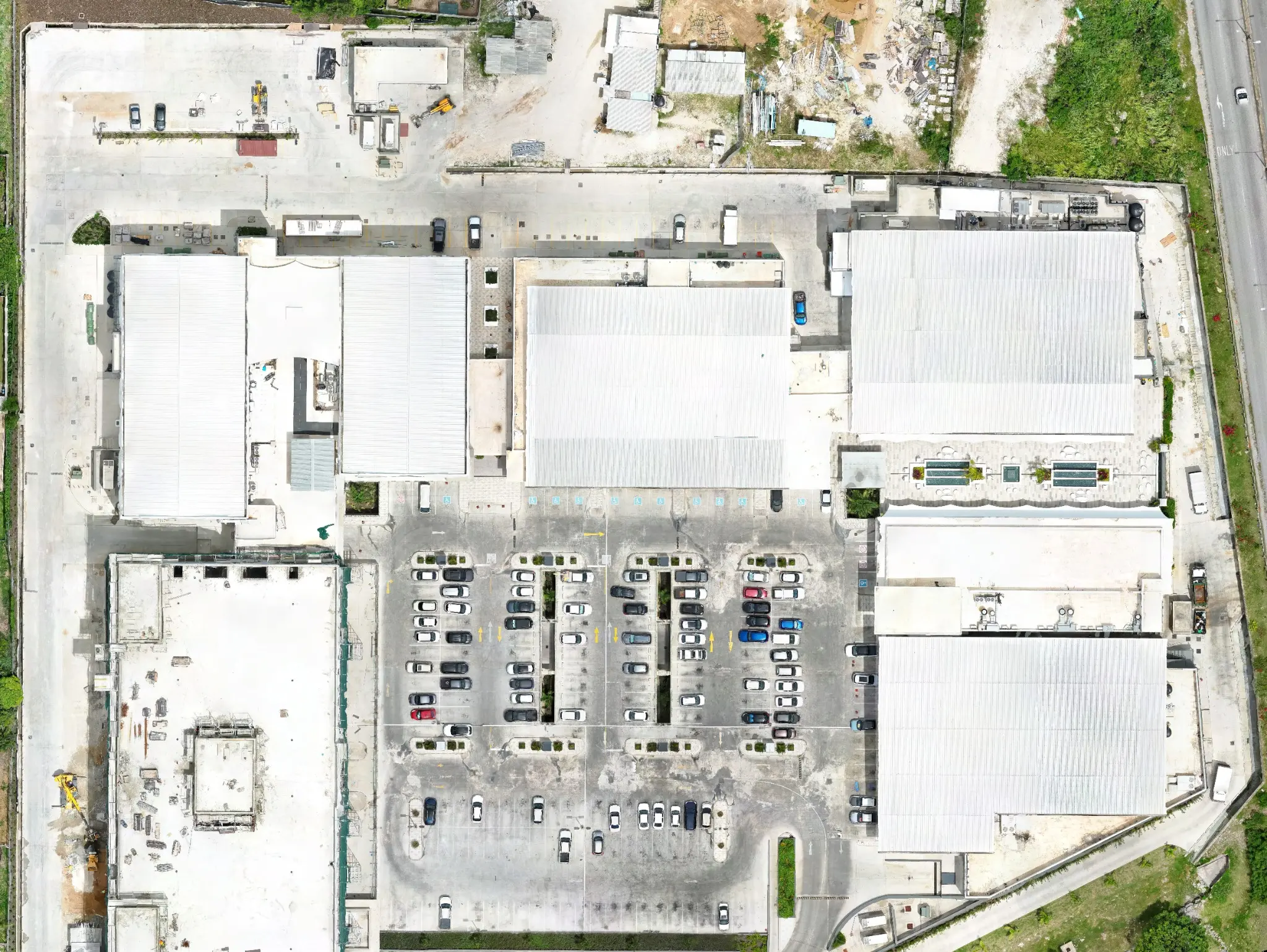
Locate → Zoom → Inspect → Reference
Visible features can be measured, traced and referenced to support existing-condition documentation, drawing updates, coordination and future comparison. Where the required information has already been captured clearly, the mapped record can also reduce repeat visits made only to recover dimensions, locations or visual context.
The orthomosaic is a measurable visual record—not a legal survey, cadastral plan or substitute for boundary verification and specialist field checks where those remain necessary.
Drawing coordination
Existing drawings establish the design or historical reference. Current mapped conditions can then be coordinated against that information to identify visible changes and support updates to site documentation.
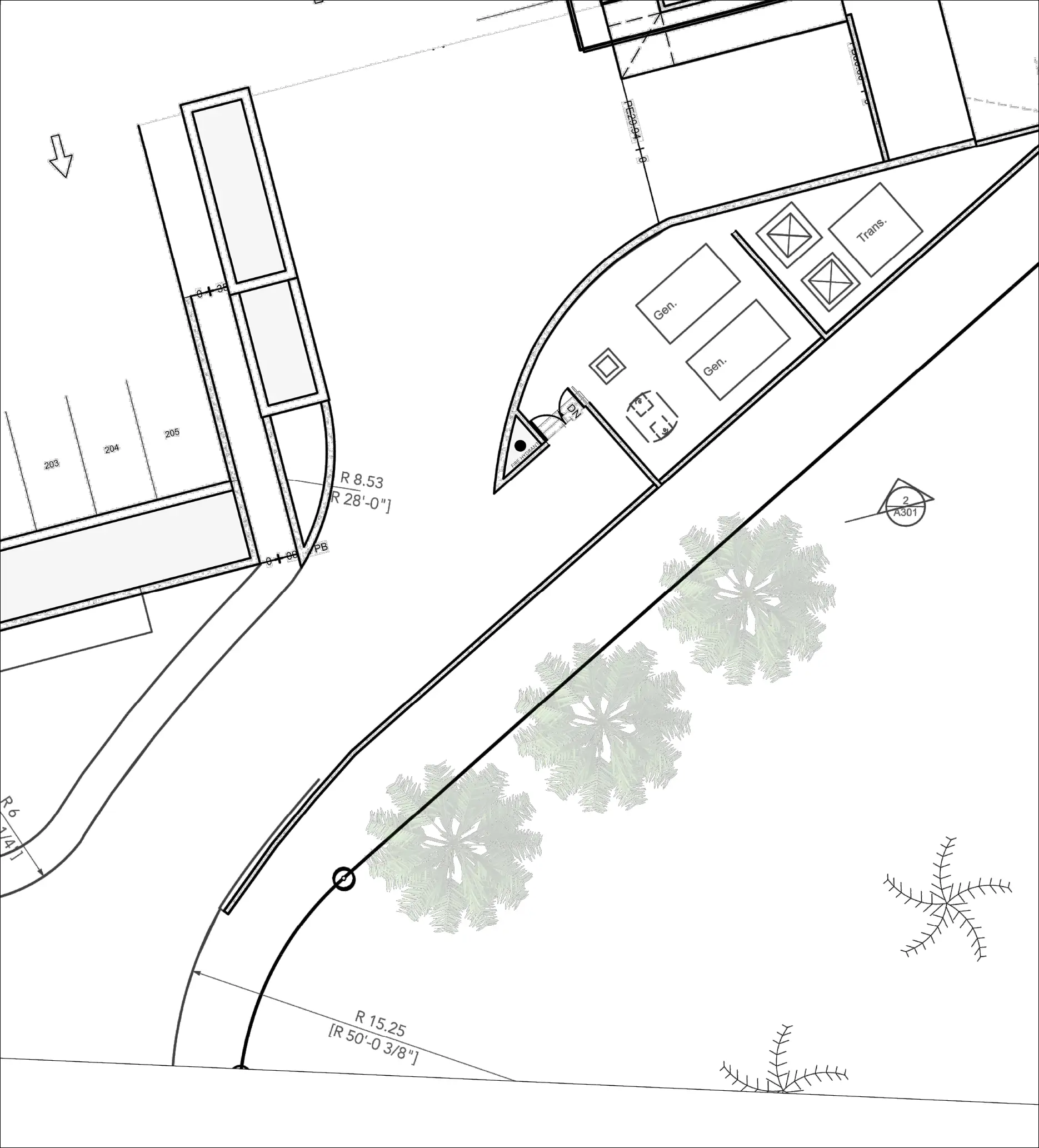
Existing drawing reference.
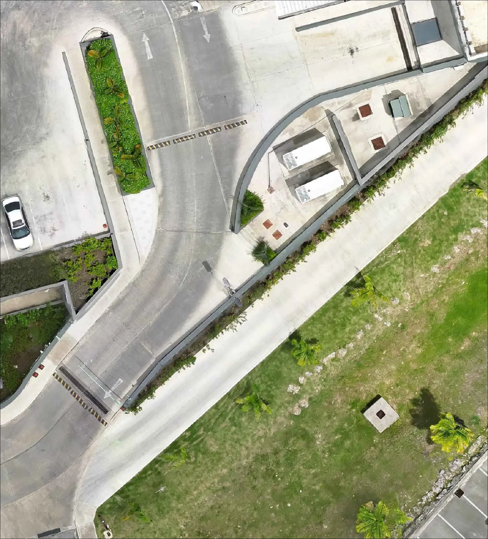
High-resolution mapped condition.
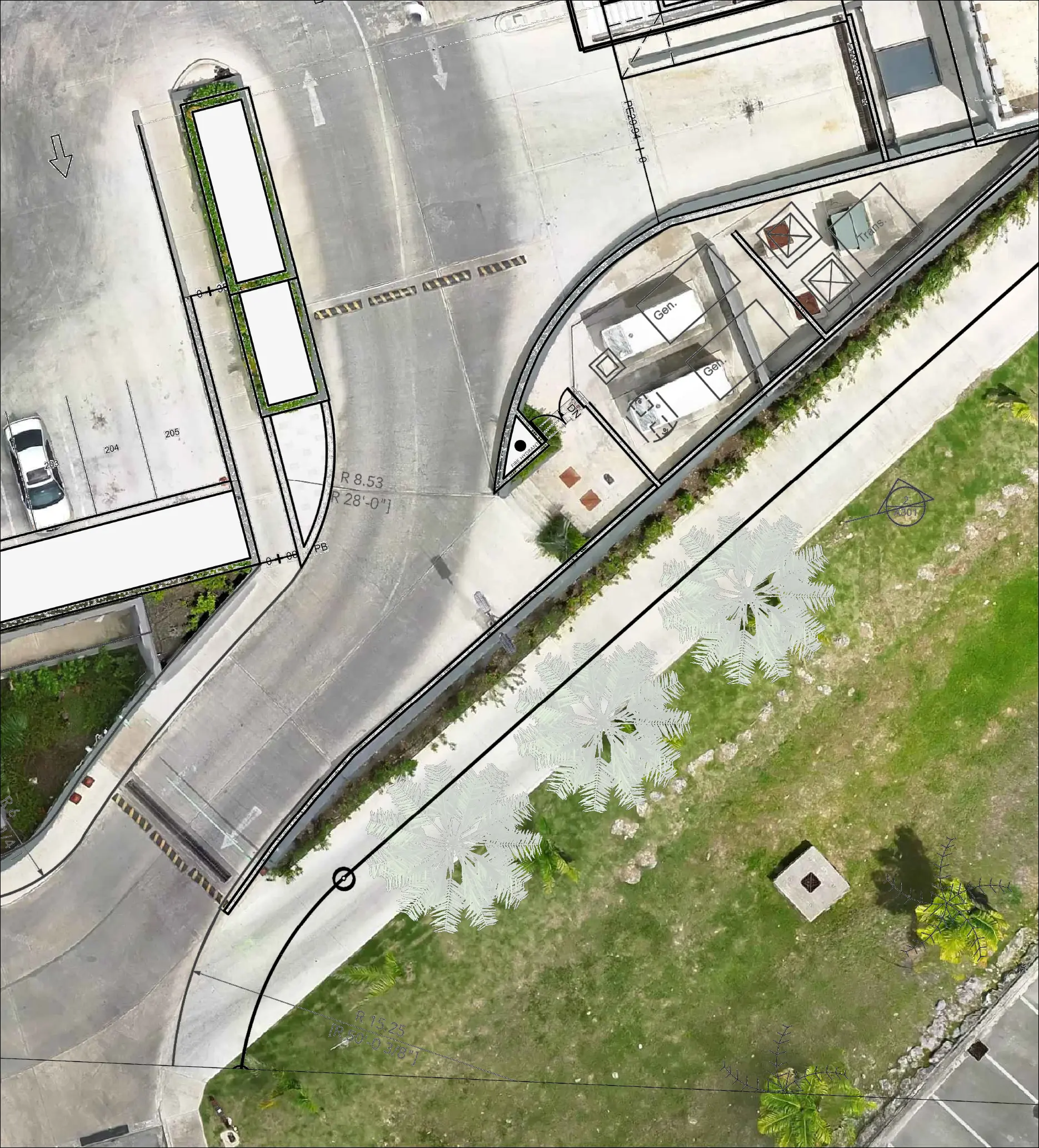
Drawing information aligned with current conditions.
Coordinating the drawing with the current orthomosaic makes visible changes in layout, access, equipment, landscaping and site development easier to identify. The mapped record can also provide a practical visual base for tracing and dimensional reference when preparing or updating drawing information.
Field verification remains necessary where accuracy, boundaries, concealed conditions or specialist assessment cannot be confirmed from the captured record alone.
Satellite vs orthomosaic
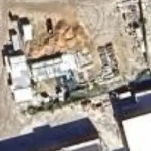
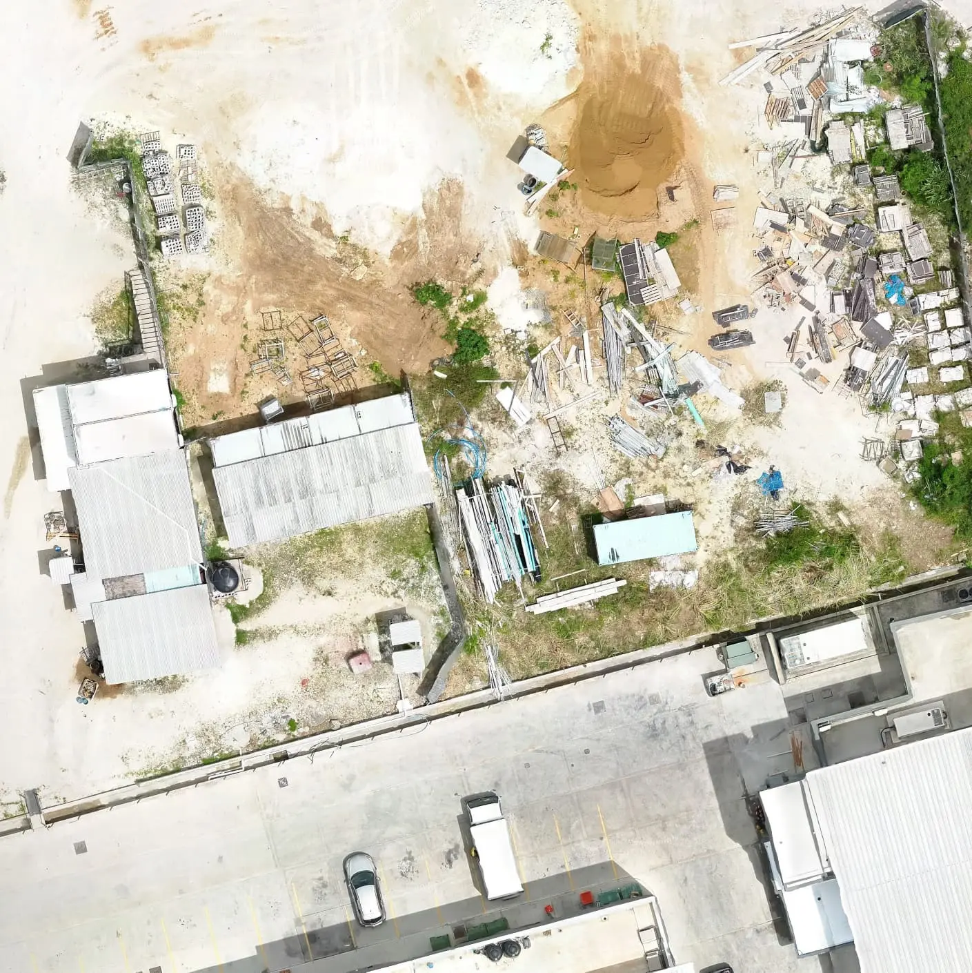
Purpose-made matched areas show the difference between general satellite imagery and a current, dedicated orthomosaic. The site-specific capture resolves physical features and present conditions with far greater clarity for documentation, coordination and inspection.
The dedicated orthomosaic resolves current access geometry, surface markings, landscaped areas, utilities and boundary relationships that are difficult to interpret in the lower-resolution satellite reference.
The current orthomosaic makes temporary works, stored materials, vehicles, work zones and adjacent building relationships legible—supporting remote review and a defensible record of what was present at the time of capture.
KAJH Aerial · Spatial documentation
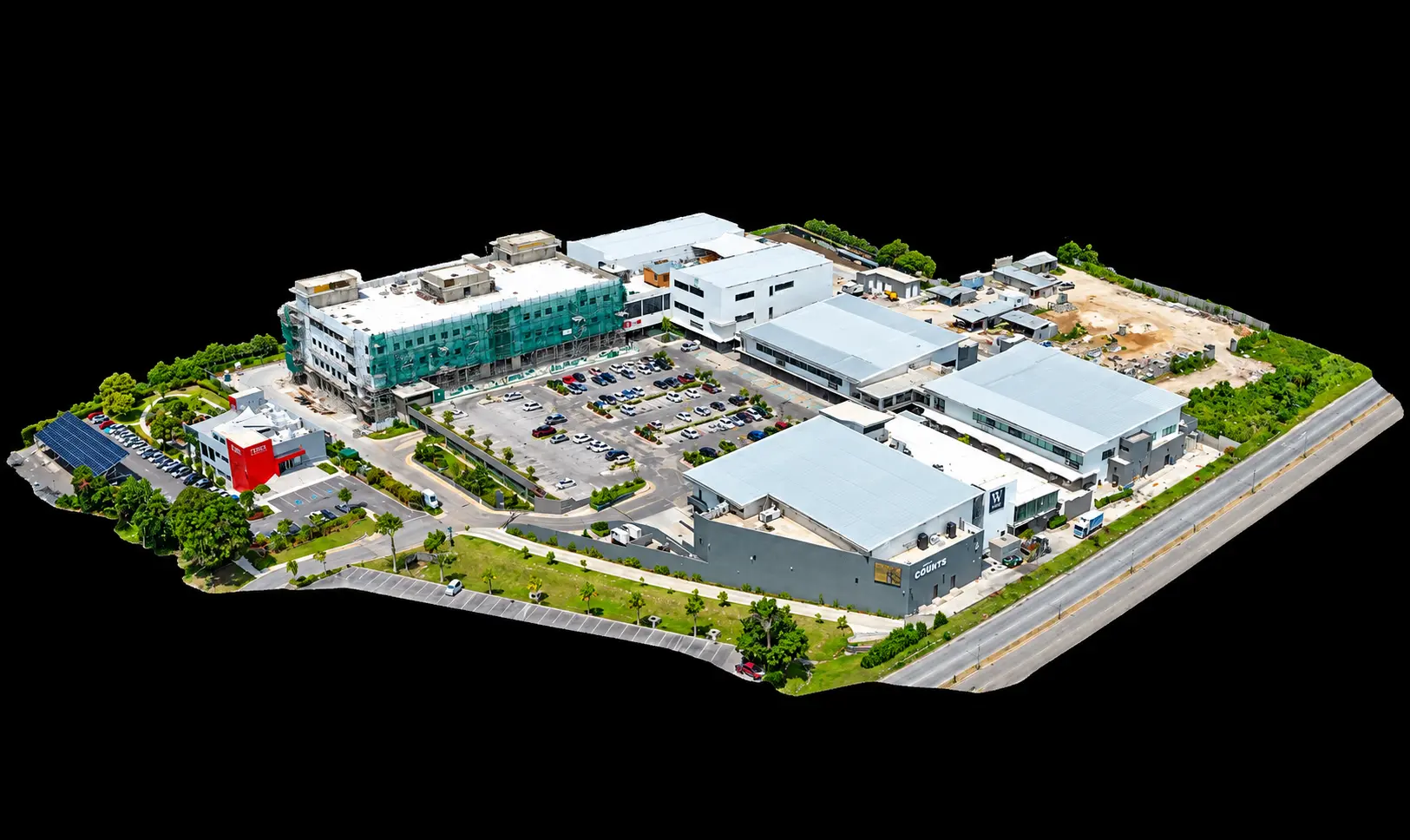
Photogrammetric capture can extend a site record beyond the conventional overhead image into a navigable three-dimensional representation of the physical environment. It supports spatial understanding, multi-angle review, remote coordination and a visual record of conditions at the time of capture.
This is a separate KAJH Aerial capability demonstration and is not presented as the W Plaza Welches model.
View 3D Photogrammetry Demonstration ↗Responsible use
The processed orthomosaic can support practical dimensional checks, site-scale assessment and coordination against drawings or previous captures.
A single top-down record brings visible buildings, circulation, external works, stored materials and active work zones into one reviewable deliverable.
Suitable uses and accuracy expectations are confirmed for each assignment. This project is not presented as a certified land survey, cadastral record or legal boundary document.
KAJH Aerial · Barbados